
Top 9 FAQ’s for Buying New Farm Tech
Nov 03 2021 As an Account Manager at Pasture.io, my job is to help farmers get the most from our technology. Every day, farmers reach out to me via a phone call, SMS, or email, with questions ranging from the basic (cost, referrals, features, etc) to the more complex (technical explanations, comparisons, and accuracy assessments).
Often, they’ll also want to know what questions they should be asking. What do other farmers want to know, and is there anything else they haven’t considered? So, here are the nine most commonly asked questions, and the answers I give to Pasture.io customers. No matter what agtech or software you’re considering adding to your toolkit, these questions are a good place to start the conversation with a potential new provider.
1. What does it do?
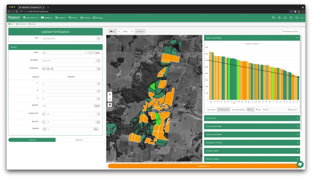
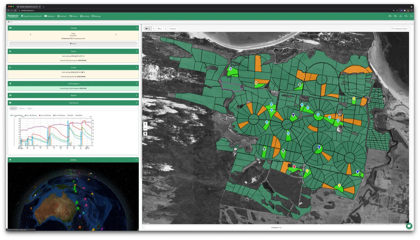
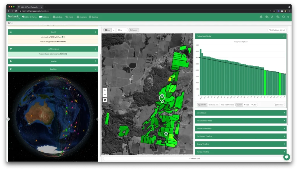
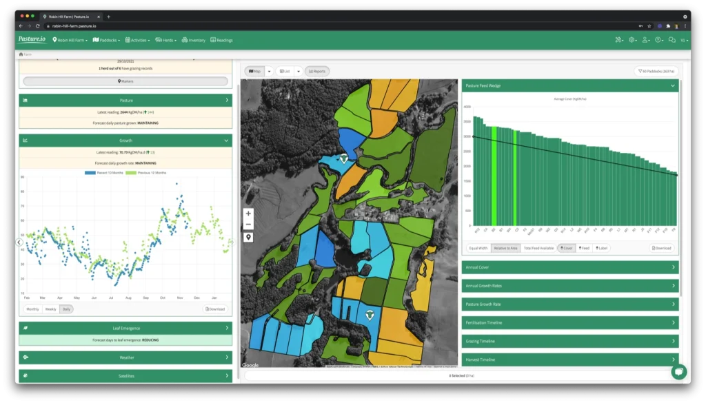
The Pasture.io app automatically measures the quantity of pasture in each of your fields. It also calculates the growth rate for each paddock. The app shows historical trends, as well as a 14 day forecast on pasture covers, growth and leaf appearance rates.
You can then make supported grazing decisions. Additionally, you can use the app for recording paddock activities such as fert, spraying, planting and harvesting. Think of the service as a decisions support tool that removes the need for pen, paper, and a calculator.
Of course, it is a lot more complex under the bonnet, but you needn’t worry and can focus on the important numbers.
2. How does it work?
The app tracks over 200 satellites, combining both public and private (premium) satellites that monitor atmospheric conditions through to delivery images of your paddocks.
Along with the satellites, we send the images into a machine learning models along with weather information and paddock activities. This model then produces the pasture numbers such as cover, growth rate and leaf appearance.
The whole process is automatic and happens daily without any labour walking or driving the farm.
Similar to a hybrid car, you can run on manual, automatic or both types of measurements.
3. How do the satellites work?
For intensive grazing, we work with the premium satellites that fly over your farm daily. This frequency is especially important in cloudy conditions found in higher rainfall zones.
For extensive grazing, we work with public satellites that provide less frequent and lower resolution images. These satellites are ideal in lower rainfall zones.
Each day we download the available images and run the data through many types of processes for cleaning and making sure the image is fit for use. You don’t need to worry about this, other than watching the latest images land in the app.
One interesting feature is the in-app satellite tracking, where you can view where the satellites are flying over the world at any time of the day. Be warned, you can lose a lot of time mesmerised by the movement of the satellites!
4. How much does it cost?
The pricing for the satellite readings depends on the subscription level. The farm app that runs everything is free to use with manual information.
We set up each farm with a digital paddock map, whether a free account or a satellite plan and this ensures that each farm experiences a smooth training and onboarding.
If you farm in a high rainfall area, we’d suggest one of the premium satellite plans. If you farm a more extensive grazing system, we can offer a less intensive model that doesn’t need to run daily and is far cheaper.
Otherwise, if you’re keen on manual measurements or looking for a digital paddock app, then the app is all yours to use for free.
5. Is it the same as LIC Space?
This question is one that I get asked a lot by our New Zealand farmers. The answer is a flat-out no. Primarily, we deliver a lot more readings, and from what I hear, our readings are a lot more accurate. This reporting doesn’t surprise me for a few reasons.
The first is that we have a farmer approach to building the models. For example, our founder is from a farming family and knows the requirements on the ground.
The second is that we use more satellites or don’t put a handbrake on our annual image procurement. This means that if the sun is shining and the sky is clear, you should receive a new satellite reading.
Thirdly, we provide the information in a format that is a decision support tool. This platform is contrasted to the simple emailer that LIC Space sends out once a week.
And lastly, we cover a broad array of production systems from intensive to extensive grazing, varying pasture swards, and support dairy, beef and sheep farmers across multiple continents.
6. Do you have any studies on the accuracy?
Yes, and we work with universities and industry bodies worldwide on an ongoing basis. They’re constantly giving us feedback and working with us to deliver a highly accurate service.
Additionally, we have analysed hundreds of thousands of measurements across the world. These manual measurements mainly cover ryegrass-based swards (and mixed with plantain, chicory, clover and so on) as well as Kikuyu based swards.
Note: This is a great question, and one that your service provider should be ready and willing to answer. High accuracy levels from us mean lower risk, a longer relationship with you, and easier decision making for you. We’re open and transparent about our accuracy – and we’re continuously working to refine and improve the service.
7. How does it compare to my manual measurements?
The measurements stack up very well. They trounce the eyeball method, which is the least accurate method –surprise-surprise!
In terms of rising plate meters, our measurements are more often way better than not. For example, a rising plate meter tends to have a variance of approximately 150 kilos plus per hectare. Our models run around the 60-kilo mark.
Contrast this with the eyeball method, which typically runs at 400 kilos and more on the better end. The main goal here is to deliver a service with high relative accuracy.
Note: Comparing any measurement method is not ideal. You see, what happens is that people tend to think that the method they use has a high absolute accuracy, when no one knows the measurement accuracy at the absolute level. It is much more important to compare accuracy at the relative level and then optimally adjust the management practices around the numbers.
8. It’s cloudy where I am. Will I get satellite readings?
Yes, you will. The average farmer we work with receives a satellite measurement every 2.8 days on average.
Further, we have built a ‘cloudy days’ model that generates a reading for each paddock every day of the year for pasture covers and growth rates. Also, these numbers, along with a leaf emergence, are given on a rolling 14-day forecast.
The main thing here is that the cloudy days model steps in if you happen to have ten or more days of overcast weather.
This model generates growth rates from today’s climate and doesn’t use the growth rate of last week or the week before to grow your paddocks. This model puts the readings ahead of any manual measurement with up-to-date growth rates based on weather conditions for each paddock.
9. Who else is using it in my area – can I speak with them?
If we work with a farmer in your area, we will try to put you in touch. However, this will depend on whether the farmer is okay with us sharing their details.
Usually, not to worry, we’ve found that most farmers are happy to take a call and discuss different farm management topics, and this is what makes my job talking with you all the more exciting.
I love how Pasture.io has been helping farmers for the past 3 years, of late I have had existing clients of ours request to use our program for their second farm and it’s only the beginning! I’m excited to see what we can do with this amazing piece of technology next.
If you have any questions that come to mind, I’d love to hear from you and discuss all things with your farming operations.
Get in touch with Gabriella Moric, Account Manage at Pasture.io Pty Ltd: support@pasture.io
Check out the Pasture.io Smart Grazer App in the Directory.
Posted in Farmer Advice
You Might Also Like
Jul 08 2026
New era for AgTech Finder to deliver opportunities for farmers and tech companies
Change in ownership announced, with REALM Group to lead the next phase of the digital platform.
Read MoreJul 23 2025
Low yields from wheat production? Here’s why.
For the past two decades, agronomists and farmers have been trying to solve the problem of low yields using Variable Rate Fertilisation application. However, yield is only half of the equation. In-field…
Read MoreMay 25 2025
Get more from your livestock data with these six agtech solutions
Farmers across Australia are producing more data than ever. But much of it remains frustratingly siloed. Here’s how you can get the most from your data as a livestock producer.
Read MoreMay 20 2025
Purchasing AgTech? Ask yourself these five questions first.
Whether it’s your first time, or you’ve already got plenty of technology in operation – asking the right questions ensures you take the best approach.
Read MoreGet listed on AgTech Finder.
AgTech Finder helps Australian farmers and producers find the product that’s right for them.
Register now to be a part of the community, get access to a national platform and start gaining insights to improve your products.