GoSat
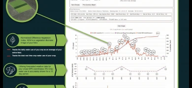
The Goanna GoSat platform has integrated IrriSat technology driven by NDVI imagery combined with localised weather data from our privately held weather station network to measure crop water use for benchmarking crop productivity.
To do this, GoSat utilises NDVI imagery and site specific weather data. GoSat reports on seasonal crop water-use-efficiency that can be conducted at paddock, farm, valley and industry scales. It will calculate the crop’s WUE per kg/mm and $/mm which can be used for benchmarking other crops or varieties in irrigated and drylands farming.


